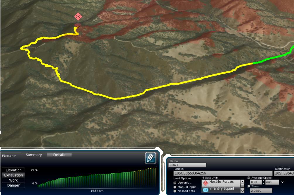
Circa 2012 — the original standalone prototype, with later work on the RaptorX-based variant.
The problem
A route on a map is only part of a planning problem. Terrain, carried load, environmental conditions, and human performance can change what that route means for the people traveling it.
LAREDO brought those concerns into a visual geospatial planning environment. The work combined three-dimensional terrain visualization with load and route analysis.
My role
My involvement included software architecture and hands-on development, followed by technical direction as the work evolved. That included thinking through how modules and related geospatial tools fit together.
The project reached a working standalone prototype. The case illustrates research and prototype development, along with the engineering work needed to connect analysis, visualization, and other systems.
The software
LAREDO allowed users to explore terrain in three dimensions and compare planning alternatives. Its interface brought the geographic view and route analysis together, helping make the factors behind a route visible.
The later LAREDO-X variant worked within RaptorX. The Army’s public overview describes its use of terrain information and human performance factors in route planning.
Public visuals
The cover image shows the original LAREDO interface from that period and comes from Applied Visions’ public LAREDO product sheet. Image credit: Applied Visions.
The U.S. Army Engineer Research and Development Center also featured LAREDO-X in Mission Planning and Geospatial Research, a public video posted in May 2015. Video credit: Bryan Armbrust, U.S. Army ERDC.
Selected outcomes
- Contributed to a working standalone prototype for terrain-aware load and route planning.